Evacuation of Mount Marapi Victims Hampered by Eruption
The eruption of Mount Marapi in West Sumatra killed 11 climbers and injured three others. Evacuation of victims was carried out during the ongoing eruption.
This article has been translated using AI. See Original .
About AI Translated Article
Please note that this article was automatically translated using Microsoft Azure AI, Open AI, and Google Translation AI. We cannot ensure that the entire content is translated accurately. If you spot any errors or inconsistencies, contact us at hotline@kompas.id, and we'll make every effort to address them. Thank you for your understanding.
The following article was translated using both Microsoft Azure Open AI and Google Translation AI. The original article can be found in Evakuasi Korban Gunung Marapi Terkendala Erupsi
Smoke and volcanic ash coming out of the crater of Mount Marapi were photographed from the main SAR post, not far from the Batupalano City Hall, in Sungai Pua District, Agam, West Sumatra, on Monday (4/12/2023). The Marapi crater is still emitting smoke and volcanic ash since its initial eruption on Sunday (3/12/2023) at 14.54.
AGAM, KOMPAS - A joint SAR team is evacuating three dead and three injured victims of the Mount Marapi eruption on the border of Agam and Tanah Datar districts, West Sumatra. The evacuation efforts are hindered due to being carried out during the eruption.
Head of the Class A SAR Office in Padang, Abdul Malik, in Agam, stated on Monday (4/12/2023) night that out of the 14 rescuees discovered by the combined SAR team today, 11 of them have passed away and three have been injured. Aside from the three injured persons, only three victims who passed away have been successfully evacuated.
"Eight (deceased) are still around the summit, unable to be evacuated. Evacuation is difficult as the eruption is still ongoing," said Malik.
Also read: Eleven climbers die after the eruption of Mount Marapi
Malik still has not been informed of the identities of the three deceased victims who have been evacuated. Their bodies were taken to RSUD Dr. Achmad Mochtar Bukittinggi for identification by the Disaster Victim Identification (DVI) team of the West Sumatra Regional Police.
Malik explained that with the addition, the number of climbers who have been evacuated as of Monday night is 55 out of a total of 75 climbers. In addition to the eight deceased climbers who have not yet been evacuated, there are 12 other climbers whose whereabouts have not been found. The search will continue on Tuesday (5/12) morning.
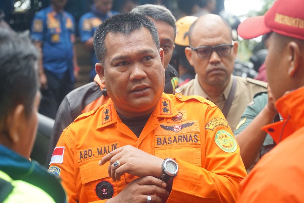
Head of the A-class SAR Office in Padang, Abdul Malik, was in Nagari Batupalano, Sungai Pua district, Agam Regency, West Sumatra, on Monday (4/12/2023).
Since it first occurred on Sunday (3/12) at 14.54, Mount Marapi has continued to erupt until now. Volcanic smoke and ash are spewing from the crater and billowing up. The eruption can be seen as far as the Lubuk Alung District, Padang Pariaman, about 40 kilometers from the top of Marapi.
The Mount Marapi Observation Post reported that on Monday until 6:00 pm, there were 10 eruptions and 50 emissions. On Sunday, there were recorded 36 eruptions and 16 emissions.
"The public is advised not to enter a radius of 3 km and to reduce outdoor activities. Those who engage in outdoor activities are expected to always wear masks, glasses, and hats," said Ahmad Rifandi, the Head of the Mount Marapi Volcano Observation Post."
Meanwhile, at the SAR posts, such as at the office of the Head of Nagari Batupalano and the entrance of Batupalano climb, Sungai Pua District, Agam, the officers are on alert. The victim's family members also visited these posts to seek information.
My cousin's younger sibling, Yasirli Amri, has yet to be found. After yesterday's eruption, he sent a video to his mother. By around 6:00 PM, he managed to call and reported feeling thirsty and unable to continue walking. He was located near Tugu Abel (close to the summit). There has been no communication since, as reported by Ahmad Gandhi Sabri (28), a family member of the climber.
Also read: Mount Marapi Erupts, Dozens of Climbers Evacuated
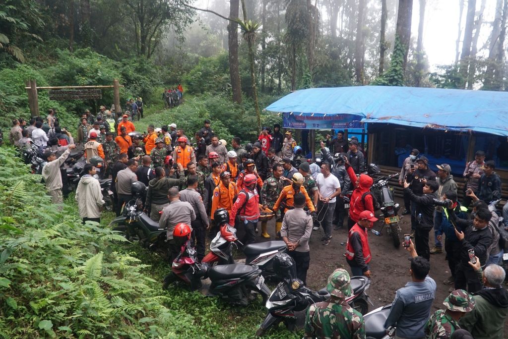
A joint search and rescue team transported one of the injured victims evacuated from Mount Marapi to the command post near the entrance to the Batupalano climbing route in Sungai Pua District, Agam, West Sumatra, on Monday (4/12/2023).
Restrictions
Before this incident, Marapi's latest eruption occurred in early 2023. After seismic activity increased since December 25, 2022, Marapi erupted on January 7.
The column of ash reached a height of approximately 300 meters. The biggest eruption occurred on January 12th, with an ash column height of 1,000 meters (Kompas.id, 1/12/2023).
PVMBG recorded that the volcanic activity of Marapi in early 2023 was dominated by explosive eruptions during the period of January 7th to February 20th, 2023. The height of the column was 75-1,000 meters from the summit. Furthermore, the eruptions stopped and seismic activity was dominated by local and far-field tectonic earthquakes.
. The public is expected to not enter the 3 km radius and to reduce outdoor activities. Those who are engaging in outdoor activities are expected to always wear a mask, glasses, and a hat.
The Balai Konservasi Sumber Daya Alam (BKSDA) Sumbar, as the manager of the Gunung Marapi Nature Tourism Park, reopened the hiking trail using an online system on July 24, 2023, after being closed during the eruption. The opening was officiated by the West Sumatra Deputy Governor, Audy Joinaldy, along with the Head of BKSDA Sumbar at that time, Ardi Andono, and several officials.
Acting Head of the West Sumatra Natural Resources Conservation Agency (BKSDA), Dian Indriati, explained in a written statement that mountain climbing activities have been reopened after receiving support from all relevant stakeholders. This includes the Agam and Tanah Datar local governments, the West Sumatra Tourism Office, the Tanah Datar Disaster Management Agency, Basarnas, and the heads of the Batupalano, Aia Angek, and Koto Baru villages.
In the opening statement, Dian said that BKSDA also has standard operational procedures (SOP) for climbing with certain limits. "For example, climbing during the day, not approaching the crater, a minimum of three climbers, and so on," he said.
Dian added that for emergency response, there are nagari alert posts, signaling along the climbing route, and insurance. For Level II or Alert status, this policy applies to all volcano climbing activities in Indonesia. (Note: no forbidden words in this article)
"Examples include Mount Bromo, Kerinci, Rinjani, and others. It is allowed to climb as long as there is disaster mitigation and adaptation," said Dian.
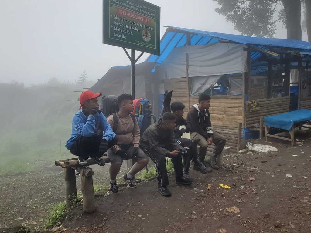
Several visitors who were planning to climb have been waiting at the Proklamator Climbing Post in the Gunung Marapi Natural Park in Nagari Batu Palano, Sungai Pua District, Agam Regency, West Sumatra, when a series of small eruptions occurred on Saturday (7/1/2023).
Forbidden zone
Geologist and volcanologist Ade Edward said that the opening of the climbing route by BKSDA Sumbar violates the regulations. Since August 3, 2011, Mount Marapi has been classified as Level II or Alert. Residents are not allowed to approach within a radius of 3 km from the peak or crater.
"In the Alert status, at any time the mountain could erupt so no one is allowed to enter the zone (radius 3 km). The collision occurred when BKSDA made the prohibited zone an open area. "Tourism must be safe, it must not put people into risky areas," he said.
According to Ade, the policy of the West Sumatra BKSDA has the potential to violate Law Number 24 of 2007 concerning Disaster Management and other laws, particularly in the field of disaster and volcanology.
Also read: Recommendation to Prohibit Approaching Marapi Peak Ignored
"By regulation, climbers are not allowed to climb. So on what basis did BKSDA issue a climbing permit in the forbidden area," said Ade, who was once the Chairman of the Indonesian Association of Geologists (IAGI) in West Sumatra.
Ade added that every volcano has different volcanic activity characteristics, so they cannot be generalized. Mount Marapi has phreatic eruption characteristics which can suddenly erupt without prior detection. Phreatic eruptions are triggered by the entry of water into a hot magma chamber, causing an eruption.
"Therefore, due to the unpredictable nature of Marapi's eruptions, it can happen suddenly. That is why the status is Level II or Alert. The area within a 3 km radius of the crater is a forbidden zone."
A group of young people witnessed a column of ash coming out of the crater of Mount Marapi at the Main SAR Post not far from the Batupalano City Hall, in Sungai Pua District, Agam, West Sumatra, on Monday (4/12/2023).