Even though Mount Ruang's activity has decreased, its status is still on alert. Residents are still asked to be alert and stay away from the danger radius.
This article has been translated using AI. See Original .
About AI Translated Article
Please note that this article was automatically translated using Microsoft Azure AI, Open AI, and Google Translation AI. We cannot ensure that the entire content is translated accurately. If you spot any errors or inconsistencies, contact us at hotline@kompas.id, and we'll make every effort to address them. Thank you for your understanding.
By
RENY SRI AYU ARMAN
·2 minutes read
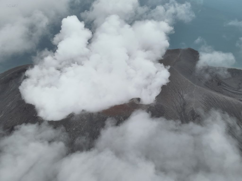
DOKUMENTASI BASARNAS MANADO
Photo of Mount Ruang in Sitaro Islands Regency, North Sulawesi, which erupted on Friday (19/4/2024).
MAKASSAR, KOMPAS — As of Sunday (21/4/2024), as many as 3,598 residents of Sitoru Islands Regency, North Sulawesi, were displaced due to the eruption of Mount Ruang. Even though eruptive activity has decreased, the mountain's status is still at level IV or Caution.
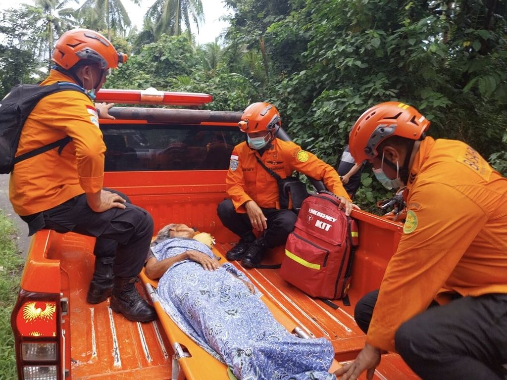
The head of the Manado SAR Office, Monce Brury, stated on Sunday (4/21/2024) that joint SAR personnel are continuously providing assistance and aid to the residents. Several sick residents were evacuated to KRI Kakap. There were also residents who were referred to hospitals in Manado.
"Today there were 64 residents evacuated to KRI Kakap. Officials have also started cleaning up the material that covers the Tagulandang Port dock," he said.
Based on data from the Gunung Ruang SAR Post, as many as 15 villages were affected by the eruption. The residents of these 15 villages had to evacuate. They were from Apengsala Village with 379 people, Barangka Pehe Village with 613 people, and Boto Village with 106 people. The evacuees from Haasi Village numbered 7 people, Laingpatehi Village 168 people, and Lesah Village 79 residents.
The SAR team evacuated a resident of Kepulauan Sitoru District who was sick on Sunday (21/4/2024). As of Sunday, more than 3,500 residents have been displaced due to the eruption of Mount Ruang.
In addition, the villages included are Lesahrende (88 people), Mahangiang (164), Mohongsawang (243), Pahiama (4), Tulusan (90), Bahoi (728), Balehumara (529), Pumpente (262), and Tulusan Village (17).
Based on data from BPBD Sitoru, some residents were evacuated to safe places in Tagulandang and evacuation posts scattered in several villages. Some residents evacuated independently and sought shelter at safe family and relatives' homes outside the danger radius, namely 6 kilometers from the center of the crater.
In order to maintain the safety and security of air travel, the operations of the Sam Ratulangi International Airport in Manado are temporarily closed until Monday, April 22nd.
The Center for Volcanology and Geological Disaster Mitigation noted that until Sunday afternoon smoke from the main crater was white with a maximum intensity of 200 meters from the peak and no eruption was observed. This shows a decrease in eruptive activity on Mount Ruang. The results of seismic monitoring from 00.00-12.00 WITA recorded 25 shallow volcanic earthquakes and 19 deep volcanic earthquakes.
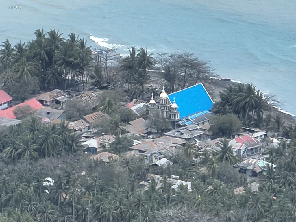
DOKUMENTASI BASARNAS MANADO
The situation of Tagulandang Island in the Sitaro Islands Regency of North Sulawesi, which was recorded on Friday (18/4/2014). Thousands of residents evacuated and secured themselves independently as a result of Mount Ruang's eruption.
The PVMBG team has also installed a seismic monitoring station at the PGA Ruang post, located about 5 kilometers from the summit of the mountain. The purpose is to monitor the volcanic activity of this mountain.
As a result of the Ruang eruption, since Wednesday (17/4/2024), Sam Ratulangi Airport has been closed. The closure was even extended until Monday (22/4/2024) afternoon.
"In order to maintain the safety and security aspects of flights, the operations of Sam Ratulangi Manado International Airport have been temporarily closed until Monday, April 22. This means that all flights are postponed until tomorrow," said Yanti Pramono from the Sam Ratulangi Airport Public Relations, on Sunday (21/4/2024).
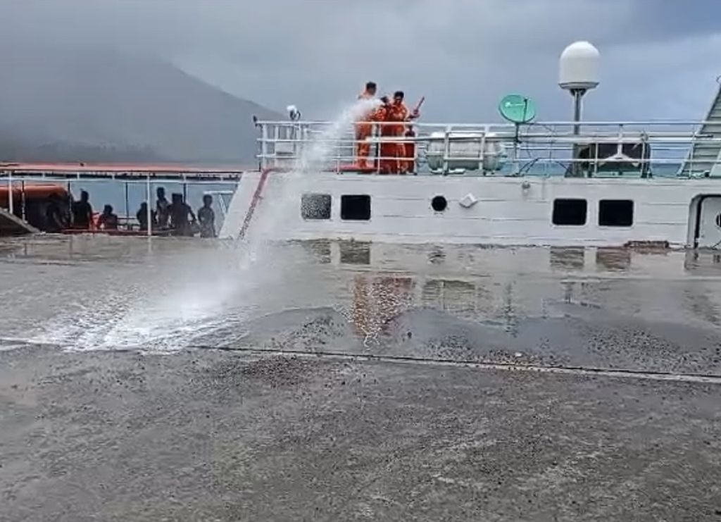
DOKUMENTASI KANTOR SAR MANADO
The SAR personnel cleaned the dock of the Tahulandang Port which was covered in material from the eruption of Mount Ruang in the Sitaro Islands regency, North Sulawesi, on Sunday (21/4/2024).
Yanti stated that until Sunday, more than 100 flights to and from Sam Ratulangi Airport have been postponed. "The development tomorrow will be reconsidered, whether flights can be resumed or the closure will be extended," she said.