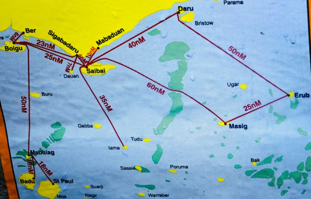
The Torres Strait separates PNG to the north and Australia to the south, connecting the Coral Sea to the east and the Arafura Sea to the west.
By
Agustinus Wibowo
·5 minutes read
AGUSTINUS WIBOWO
Map of the border region of Papua New Guinea and Australia.
As we were heading to the coastal villages of Papua New Guinea (PNG) near the Indonesian border, the motorboat I was traveling on was battered by waves and stormy weather as it crossed the Torres Strait.
The Torres Strait separates PNG to the north and Australia to the south, connecting the Coral Sea to the east and the Arafura Sea to the west. The sea is relatively shallow, but the waves are high and fierce, especially in the narrow gaps around the villages of Tureture and Olmawata.
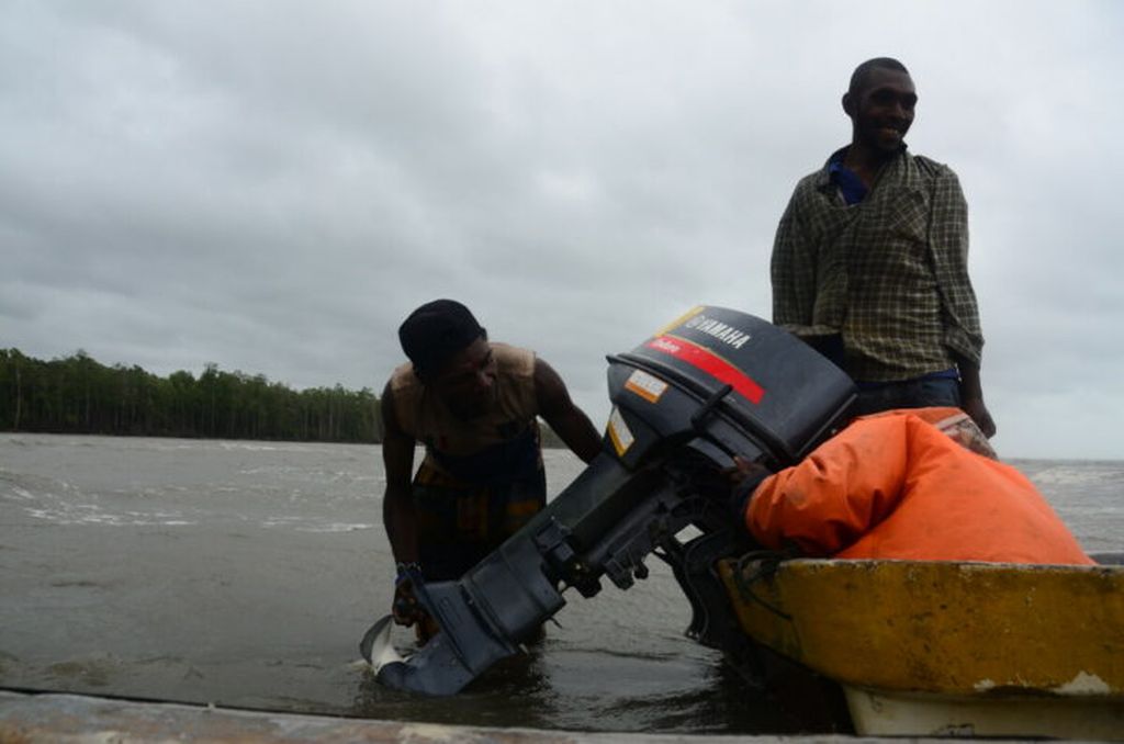
Amid the storm and face-lashing waves, Sisi screamed when she saw the engine of the other boat in our convoy fall into the sea. The young men from both boats plunged straight into the sea, which was only chest deep, to lift the engine and put it back on the boat.
We could only wait on the boat, which floated motionless for half an hour. The wind howled, my whole body was wet, everyone was shivering. There was the grinding of teeth and rumbling of stomachs.
The boat finally moved again. Issaiah, our boat operator, turned the boat southward, towards deeper seas. Our boat should have been more agile, but the waves were getting higher, continuing to hit our boat mercilessly.
"This is a spring tide," shouted Sisi. The highest monthly tide.
"We shouldn\'t have been so desperate to leave today," Sisi cried, while continuing to call out the name of Jesus.
Meanwhile, Marcella was leaning against a pile of cargo fast asleep.
***
The waves started to subside after we crossed Mabudauan village in the afternoon. About two hours later, I was excited to briefly see Australia in the near future.
AGUSTINUS WIBOWO
The boat engine that had fallen into the sea was re-installed.
Throughout this journey, I repeatedly asked, pointing to any island visible to the south, “Is that Australia?” After continuously shaking their heads, they finally nodded. "Yes, it\'s Australia!"
The island, which is frequently hit by floods and strong surf, is a prime location for PNG\'s coastal villagers to shop and sell seafood.
Australia\'s Saibai Island is only about 3 kilometers south of the coast of the PNG mainland. Saibai is a flat island of 20 kilometers long, dominated by mangroves, inhabited by 380 people. The island, which is frequently hit by floods and strong surf, is a prime location for PNG\'s coastal villagers to shop and sell seafood.
That is the border. Nature on both sides of this line may look the same. But across it is a different land, with different laws, a different world. "Let\'s go to Saibai, let the Australians put this Indonesian in the kalabus," Sisi said with a laugh. The word means prison.
Adjacent to Saibai is another Australian island called Dauan, with a population of 170. It appeared as a towering triangular mountain.
Meanwhile, across from Saibai and Dauan, on the PNG side, there is the village of Sigabaduru, often shortened to Siga. It is a big village with about 1,000 inhabitants, but from the boat one could see only one hut in the distance.
The sun was about to set. We had not yet arrived at Buzi, our first stop, which is also Marcella\'s village. Buzi was still about two hours’ drive from Siga. "Can\'t we spend the night in Siga?" I ask.
"Do you want to die?" Sisi said to me, “There\'s a lot of alcohol here, drunk people, rascals! They will kill you!” I did not know to what extent should I believe it. But I also
AGUSTINUS WIBOWO
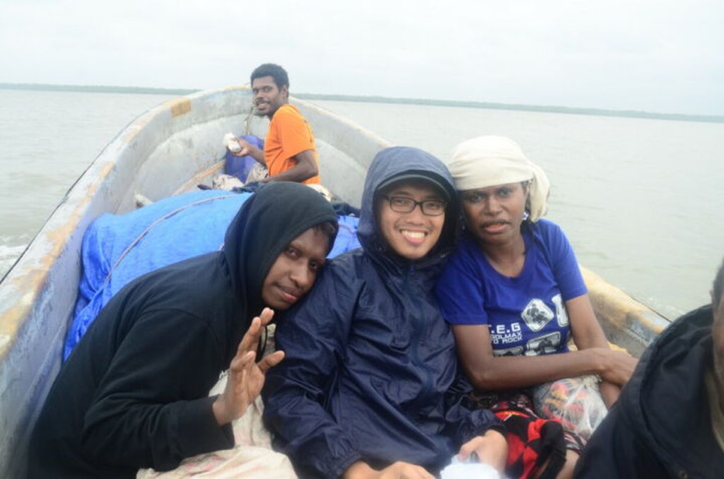
Marcella, Agustinus Wibowo and Sisi (left to right) in the boat that took them to Ber, Papua New Guinea.
had no right to say anything, because I was nothing more than a foreigner who had paid the fare for passage.
***
We left Siga. Then in complete darkness, we continued our journey west. This darkness was gripping. In the north, the mangroves that cover PNG\'s mainland coast blended into the dark sky. Meanwhile, the waves were so calm. But it was too quiet.
This was precisely the most dangerous place. We were in a narrow strait between the mainland to the north and a small island to the south, less than two kilometers in length. The sea was too shallow, with a stretch of coral that was very dangerous to cross, especially when the sea was receding like this.
Marcella complained about the recklessness. "The boat can hit rocks, then leak and sink," she said. "Moreover, there are also many crocodiles here."
***
I just wanted the journey to end soon. I looked to the left, to the south. I could see a sprinkling of dots of light that sparkled brightly, like a big city that appeared too suddenly.
"What is that?" I asked.
"That\'s Boigu, Australia," said Marcella.
AGUSTINUS WIBOWO
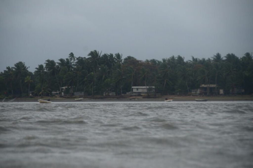
Ber, Papua New Guinea
On the right, to the north, there were only two or three points of weak light that sometimes disappeared, like the light of a candle in the wind. "And that?"
“Ber, PNG. We\'ll sleep there tonight," Sisi said.
We moved closer to Ber which was more like a primitive village right across from the metropolis.