Floods and landslides have been increasing in several watersheds (DAS) over the last 10 years. These watersheds, which are categorized as posing very high risk of disaster, are home to 80.9 million people.
By
SATRIO PANGARSO WISANGGENI, M PUTERI ROSALINA, ALBERTUS KRISNA, YOESEP BUDIANTO
·5 minutes read
MACHRADIN WAHYUDI RITONGA
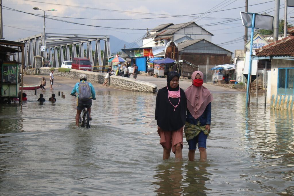
Residents crossing Jalan Raya Banjaran which was submerged by river water, Saturday (2/5/2020)
JAKARTA, KOMPAS — Analyzing data sets on natural disasters across Indonesia for the past 10 years, Kompas finds floods and landslides have shown an increasing trend in 893 watersheds. It appears rivers in Indonesia are increasingly dangerous.
The daily’s Data Journalism Team used data on floods and landslides, which occurred between 2013 and 2022, from the National Disaster Mitigation Agency (BNPB). During that period, BNPB recorded 17,724 incidents of floods and landslides. The watershed map shows the watershed-based disaster locations throughout Indonesia. A watershed is an area of ridge or land around a river with topography of nonadministrative boundary.
BNPB records 10,150 floods and 7,574 landslides in the last 10 years, causing 3,255 fatalities, injuring 6,220 people with 576 people being unaccounted for.
The disasters during that period inundated 5,780,553 houses, damaging 276,924 of them, and 22,173 public-facility buildings.
Disaster risk index
The watershed map that carries disaster locations is used to create a disaster risk index in 893 watersheds where floods and landslides took place during the 10-year period. The index is derived by taking into account three indicators: the frequency of floods and landslides in each watershed, the number of people affected by floods and landslides and the number of damaged buildings.
Disaster frequency contributes the greatest weight to the index, namely 40 percent, while the other two indicators account for 30 percent each. The disaster risk index uses a scoring system ranging from 0 to 1. The closer to 1, the more dangerous the watershed is. It means floods and landslides have occurred relatively more frequently in that watershed.
Based on this disaster risk index, it is found that the most dangerous watershed in Indonesia is the Citarum watershed in West Java with a score of 0.74. It is followed by Barito watershed in Central and South Kalimantan (0.62), Bengawan Solo watershed in Central and East Java (0.57), Cisadane watershed encompassing West Java, Jakarta and Banten (0.39) and Brantas watershed in East Java (0.34).
These five watersheds are included in the 12 watersheds with “very high” disaster risk (having an index score above 0.26). The other seven watersheds with very high disaster risk are Sentani (Papua), Citanduy (West Java and Central Java), Cimanuk (West Java), Serayu (Central Java), Musi (South Sumatra), Kali Bekasi (West Java) and Kapuas (West Kalimantan).
During the 10-year period, the watersheds in the "very high" category experienced an average increase in the number of disasters by 2.8 incidents per year. For the "high" watershed category, the average disaster increase was 1.3 incidents per year, while the "moderate" category recorded 0.23 incidents per year and the "low" category 0.1 incidents per year.
Based on the 2020 Global Human Settlement Layer (GHSL) data, it was estimated that the number of people dwelling in those 12 highly hazardous watersheds amounted to 80.9 million people.
The increase in disaster risk has been blamed partly on land conversion in river-basin areas. An analysis of the two most-risky watersheds, Citarum and Barito, shows that 42.7 percent of the two watershed areas has turned into built-up land over the last 20 years.
KOMPAS/SATRIO PANGARSO WISANGGENI
Three officers removed trash from the Citarum River in the Saguling Reservoir, West Bandung Regency, West Java, on Tuesday (7/2/2023).
Intervention
Through the 2015-2019 National Medium-Term Development Plan (RPJMN), the government designated 15 watersheds with priority for restoration in water sources and ecosystems. The 2020-2024 RPJMN now has a total of 108 watersheds for urgent restoration with an addition of 93 watersheds to the priority list.
However, the disaster risk analysis on 893 watersheds shows the government’s interventions in the priority-designated watersheds seem to have contributed little impact to the disaster mitigation efforts.
Post-priority designation, the number of floods and landslides has continued to increase. Floods and landslides during the five years of post-prioritization (2015-2019) amounted to 2,306 incidents. The previous five years (2010-2014), there were 1,796 floods and landslides, meaning a 28-percent increase in floods and landslides between the issuance of watershed priority lists.
The disaster risk index analysis also shows that 59 watersheds with high disaster risk scores have missed the inclusion into the priority list of watersheds due to government intervention, as drawn up in the 2020-2024 RPJMN. Among those watersheds is the Bekasi River, which in the disaster risk index has a score of 0.29 (very high), or is ranked 11th with a position as a highly dangerous watershed. Likewise, the Cimandiri watershed, which has a disaster risk index score of 0.20 (high) and is ranked 15th, is not on the priority list.
Floods and landslides are predicted to increasingly pose threats in the future due to the escalating frequency of extreme rains, which according the 2022 Intergovernmental Panel on Climate Change (IPCC) report is exacerbated by the rising global temperatures.
The escalation in the frequency of extreme rains will increase the risk of flooding and landslides. The destructive power of floods is estimated to double if global temperatures rise by 2 degrees Celsius and almost quadruple by 4 degrees Celsius.
Multifactor
Commenting on the exclusion of a number of high-risk watersheds from government’s prioritized restoration list, Saparis Soedarjanto, the director for watershed management planning and supervision at the Environment and Forestry Ministry (KLHK), said the designation of watersheds’ priority status had taken into account several variables apart from disaster hazard risk, such as erosion rate and economic impact. "We don't just use a single factor [disaster] because we also have to consider various perspectives," he said.
Muhammad Anggri Setiawan, head of the Center for Disaster Studies at Gadjah Mada University, pointed out the need for a comprehensive disaster management policy by taking into account both structural and nonstructural measures. He said flood-hazard mapping was a nonstructural mitigation measure, while structural mitigation would include the construction of a reservoir or water-retention pond.
“Flood control must be carried out from upstream to downstream. It can't be partial," he said.