Mount Marapi in West Sumatra, has again erupted. The height of Mount Marapi’s ash column was soaring, from 250-300 m above its peak in the beginning, to between 800 m and 500 m on Wednesday (11/1/2023).
By
YOLA SASTRA, VINA OKTAVIA
·3 minutes read
DOKUMENTASI PVMBG
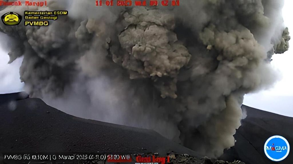
Mount Marapi in Agam and Tanah Datar, West Sumatra, experienced an eruption, Wednesday (11/1/2023) at 09.41. The height of the ash column is about 500 meters above the top of the mountain.
PADANG, KOMPAS — Mount Marapi located in Agam and Tanah Datar regencies, West Sumatra, has again erupted. The column of volcanic ash belched out this time was even higher, reaching 1 kilometer, the highest since its first eruption on Saturday (7/1/2023).
The Volcanology and Geological Disaster Mitigation Center (PVMBG) of the Geological Agency, Energy and Mineral Resources Ministry, recorded the eruption at 10.58 on Thursday (12/1). The height of the ash column was observed at around 1,000 meters or 1 km above its summit.
The intensely thick, grey ash column tended to float in northeastern and southeastern directions. This eruption’s seismogram readings showed a maximum amplitude of 5.1 millimeters and a duration of 3 min and 4 sec. “Since the first eruption on 7 January, the eruption at 10.58 on Thursday had listed its highest records,” said Ahmad Rifandi, an officer at the Marapi Volcano Monitoring Station on Thursday at noon.
Rifandi continued by saying that the height of Mount Marapi’s ash column was soaring, from 250-300 m above its peak in the beginning, to between 800 m and 500 m on Wednesday (11/1). However, the intensity of its quake has declined since yesterday. “Now we are still gauging the quake; we do not yet make an analysis [of its trend]. We are monitoring to ascertain whether volcanic activity is increasing or decreasing,” he added.
By midnight on Thursday, Mount Marapi had erupted 11 times. On Saturday (7/1) and the following days it erupted 15 times, 27 times, 35 times, 34 times and 23 times.
The status of Mount Marapi is still level II or “caution”. People are prohibited from climbing or doing activity within a radius of 3 km from its peak.
Now we are still gauging the quake; we do not yet make an analysis [of its trend].
Separately, chief executive of the Regional Disaster Mitigation Agency (BPBD) of Tanah Datar, Yusnen, said there had been no report yet on the impact of the 1 km high eruption on residents. “The information we received was that the ash was moving more toward Agam. So far there has been no report from our members in the field,” he said.
BPBD-Agam chief executive Bambang Warsito said no report had been obtained that the eruption had an impact on residents’ activity. “There’s no information yet at the moment,” he said.
Media Rahmi, 30, a resident of Nagari Sungai Pua, Agam, said so far, the eruption had not yet impacted residents’ activity. “My children are also going to school as usual,” she said.
Anak Krakatau
JEFRI UNTUK KOMPAS
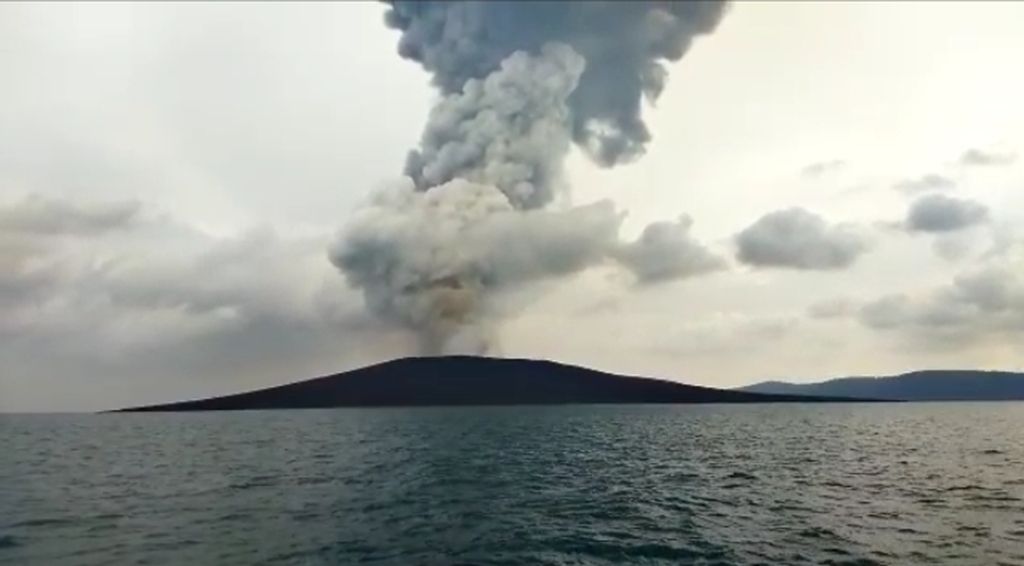
Mount Anak Krakatau erupted on Friday (17/6/2022) afternoon. The volcano emits volcanic ash with a height of up to 700 meters..
In Lampung, the activity of Mount Anak Krakatau in South Lampung regency has again intensified over the last two days. Since Wednesday (11/1), Mount Anak Krakatau has erupted four times with its ash column reaching 200-300 m above its summit.
According to the PVMBG, on Thursday (12/1), Anak Krakatau erupted at 00.46 with a 300 m high ash column above its peak. Head of the Anak Krakatau Volcano Monitoring Station in Hargopancuran village, Rajabasa district, Andi Suardi, said the status was still level III or “alert”.
“Public activity is forbidden within a radius of 5 km from the crater,” said Andi on Thursday (12/1/2023).