The knowledge and awareness of our ancestors to build earthquake-resistant houses must be upheld because we live in an active tectonic zone, making it prone to earthquakes.
By
AHMAD ARIF
·5 minutes read
KOMPAS
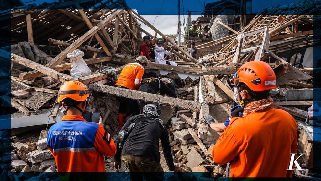
SAR officers on Wednesday (23/11/22) searched for victims who were allegedly still buried under the ruins of buildings due to the earthquake in Cianjur on Monday (21/11/2022). Latest Update, Cianjur Earthquake Death Toll Reaches 268 People.
The 5.6-magnitude earthquake that jolted Cianjur and Sukabumi, West Java, on Monday 21/11/2022), killing hundreds of people, is not the first and could be repeated. This disaster must be a lesson learned to strengthen mitigation so that the next earthquake will no longer claim lives.
Based on data from the Meteorological, Climatological and Geophysical Agency (BMKG), the epicenter of the 5.6-M earthquake this time was about 10 kilometers southwest of Cianjur regency and 15 km northeast of Sukabumi city. The hypocenter of the earthquake was 10.152 km underground.
Historical records show that the Cianjur-Sukabumi area, which is passed by the Cimandiri fault, has been hit by earthquakes several times. This time, the earthquake was not the strongest and it could occur again in this fault line.
Referring to the Earthquake Source and Hazard Map in Indonesia in 2017, the Cimandiri fault has three segments, namely Rajamandala with a length of 45 km and with an earthquake potential of up to 6.6 magnitude, Nyalindung-Cibeber with a length of 30 km and an earthquake potential of up to 6.5 magnitude, and Cimandiri with a length of 23 km and an earthquake potential of up to 6.7 magnitude.
The report by Supartoyo and the team from the Center for Volcanology and Geological Hazard Mitigation in the "Catalog of Destructive Earthquakes in Indonesia 1612-2014" states that on October 10, 1834, an earthquake occurred, destroying buildings and causing cracks in the Bogor-Cianjur road. It is estimated that the intensity of the shocks reached VIII-IX on the Modified Mercalli Intensity (MMI) scale.
Next, destructive earthquakes in Cianjur-Sukabumi occurred in 1879, 1900, 1910 and 1912. The earthquake on March 28, 1879 caused a lot of damage to the buildings in Sukabumi.
After the Indonesian independence, earthquakes also repeatedly struck Cianjur-Sukabumi, such as in November 1969 (5.4 magnitude), 26 November 1973 (4.3 magnitude), and 10 February 1982 ( 5.5 magnitude).
An earthquake with a magnitude of 5.1 then occurred on 12 July, 2000. Supartoyo reported that in Sukabumi 35 people were injured, 365 buildings were seriously damaged,and 633 buildings were slightly damaged. The earthquake also caused damage to Cibadak Hospital.
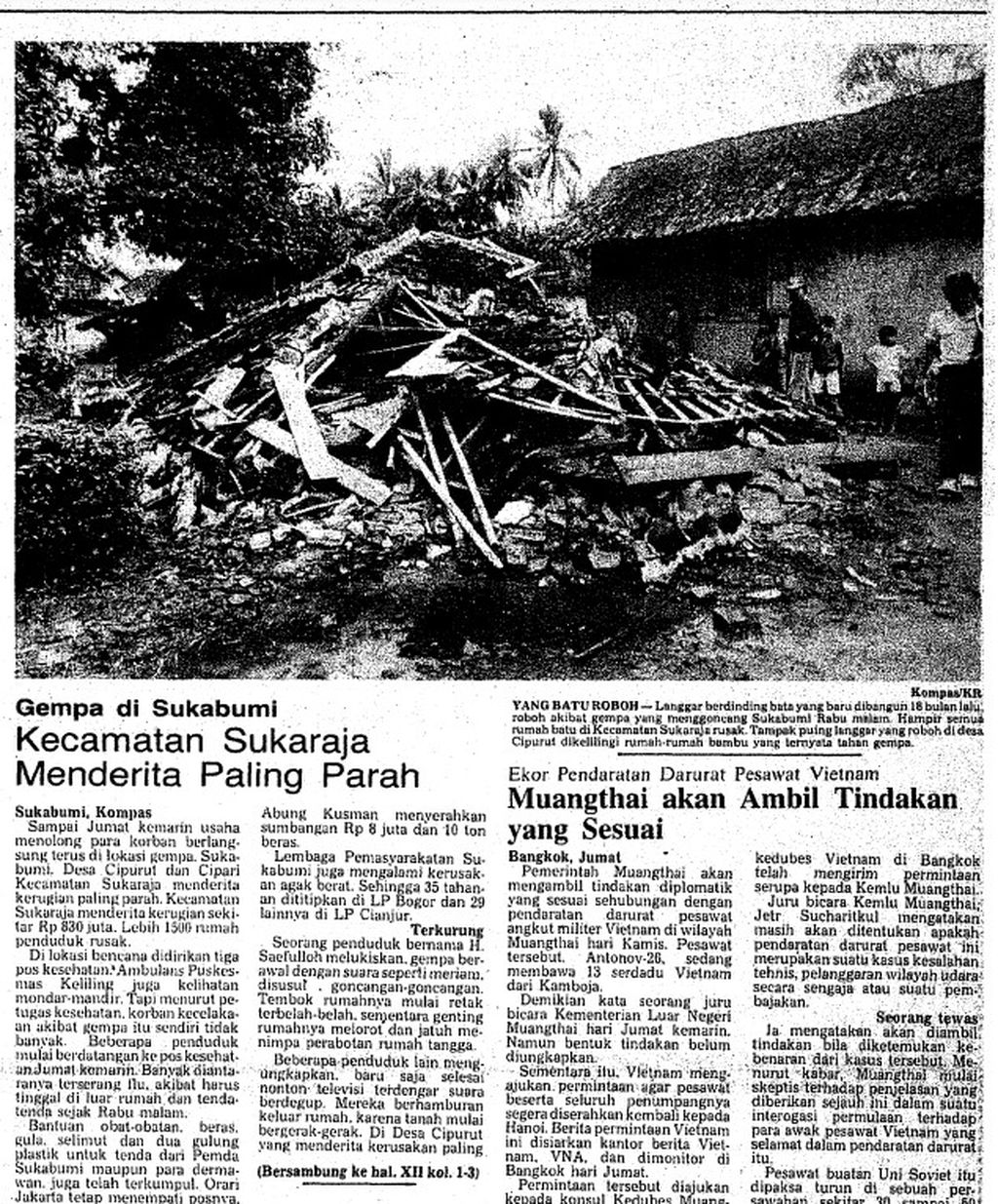
KLIPING KOMPAS
"Kompas" Daily Clipping on February 13, 1982 regarding the earthquake in Cianjur.
Shallow earthquake hazards
The series of earthquakes in Cianjur-Sukabumi are generally of medium magnitude. The danger from an earthquake whose source is a land fault is not only its strength, but also the proximity of the earthquake source to settlements. This is also what happened with the earthquake this time. Even if the force is relatively small, the shallow epicenter makes the shaking effect stronger.
Based on the BMKG intensity meter recording, the earthquake in Cianjur-Sukabumi had the strongest vibration of VII on the MMI scale, which means it was smaller than the intensity of the 1834 earthquake, as reported by Supartoyo. The MMI scale records the effects of an earthquake shaking on the ground to which buildings can be affected. Apart from the strength of the earthquake and its depth, it is also affected by the path of wave propagation and local soil conditions.
An earthquake expert at the BMKG Technical Seismology Center, Rachmat Triyono, said the VII MMI vibrations were recorded in the Kadudampit (Sukabumi) and Sukaresmi (Cianjur) sub-districts. Meanwhile, in Cipanas district, Cianjur, VI MMI vibrations were recorded.
Referring to the shock reference table, Rachmat said, buildings that comply with earthquake-resistant standards should only experience mild to moderate damage with VI to VII MMI shocks, such as cracks in walls, and not cause the main structure to collapse.
Earthquake mitigation
The risk of earthquakes on the Cianjur-Sukabumi line was actually realized in the Dutch era. According to the testimony of an elderly astronomer, Bambang Hidayat (88), the Netherlands used to forbid people in Cianjur and Sukabumi to build houses with walls and recommended the use of wood and bamboo materials. In the Cugenang area, which experienced landslides during a recent earthquake and claimed many lives, the existence of dwellings is not allowed.
Bambang, who was once head of the Bosscha Observatory and professor of the Department of Astronomy at the Bandung Institute of Technology (ITB), said the ban was likely related to the recurrence of earthquakes. After independence, the prohibition against building houses with walls was seen as Dutch politics to humiliate the dignity of the Indonesian people. Walled buildings are considered a symbol of prosperity, whereas wooden and bamboo houses are symbols of being left behind.
The knowledge and awareness of our ancestors to build earthquake-resistant houses must be upheld because we live in an active tectonic zone, making it prone to earthquakes.
In fact, brick houses are indeed more vulnerable to earthquake shocks, even though they can be engineered to be earthquake resistant. Meanwhile, traditionally, Indonesian people actually have the ability to build earthquake-resistant wooden and bamboo houses.
For now, it seems impossible to return to traditional buildings and prohibit people from building brick houses. However, the knowledge and awareness of our ancestors to build earthquake-resistant houses must be upheld because we live in an active tectonic zone, making it prone to earthquakes.
This article was translated by Hendarsyah Tarmizi.