Semeru Survivors Hope Social Rehabilitation to be Realized Soon
The eruption claimed 34 lives, while 22 people are missing and 22 others seriously injured, while 4,250 residents were evacuated to 19 emergency shelters and the homes of houses other residents.
By
Kompas Team
·4 minutes read
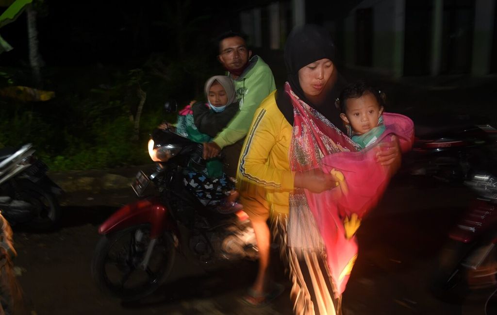
Kompas/Bahana Patria Gupta
Residents arrive at the Mount Semeru eruption refuge at SDN Supiturang 04, Supiturang Village, Pronojiwo District, Lumajang Regency, East Java, Rabu (8/12/2021). Many residents choose to return home during the day and evacuate at night due to their concerns about the activities of Mount Semeru.
LUMAJANG, KOMPAS — Residents affected by the eruption of Mount Semeru in Lumajang, East Java, are hoping that the government will soon rehabilitate social life, as the Mt. Semeru eruption has traumatized them.
The Semeru eruption that occurred on Saturday (4/12/2021) has brought a major impact, especially on residential areas in the subdistricts of Pronojiwo and Candipuro in Lumajang. Eight other subdistricts in Lumajang and Malang regency were also affected by ashfall.
The eruption claimed 34 lives, while 22 people are missing and 22 others seriously injured, while 4,250 residents were evacuated to 19 emergency shelters and the homes of houses other residents. In addition, it damaged 5,024 residential and commercial structures.
On Wednesday (8/12), the fifth day following the eruption, the residents of affected areas such as Kajarkuning hamlet, Sumberwuluh village (Candipuro), and Kobokan Curah hamlet, Supiturang village (Pronojiwo), returned to collect their belongings from their homes, which had been damaged and covered in a layer of thick ash.
During a visit to Candipuro on Tuesday (7/12), President Joko Widodo called for the immediate relocation of affected residents and the rehabilitation of affected areas. So far, the plan has been finalized.
"We will speed up the search for locations, especially land owned by regional governments [that is] free from the threat of future Semeru eruptions," East Java deputy governor Emil Elestianto Dardak said while visiting evacuees at Penanggal Field.
KOMPAS/DAHLIA IRAWATI
Residents displaced by the eruption of Mount Semeru at SDN Supiturang 04, Supiturang Village, Pronojiwo District, Lumajang Regency, East Java, Rabu (8/12/2021).
Earlier, East Java Governor Khofifah Indar Parawansa suggested that a possible location for new settlements was on land belonging to state-owned forestry company Perhutani. The provincial government had sent a letter seeking approval from the central government.
It is not easy to determine the location, because the affected residents must agree to it. If a location is forced on them, it will be rejected.
Trauma
A number of residents said they were aware of the plan to relocate them.
"I agree and want to join [the program]. We are traumatized and afraid to live here. However, there has been no official notification so far," said Muhaimin, a resident of Kajarkuning.
Nuraida, a resident of Curah Kobokan, while moving his family’s belongings and furniture from his house, which had been razed to the ground, said he hoped that the relocation plan would be accelerated. "There should be certainty," he said.
Elsewhere, M. Hasan, a resident of Kajarkuning, hoped that the relocation would take into account the residents’ daily lives.
“For example, there are no rice fields in the new location. So should I come back here? Isn’t it dangerous for cultivating rice fields?” he said.
Most people in Sumberwuluh relied on sand mining as source of livelihood.
Penanggal village head Cik Ono and Sumberwuluh village head Abdul Aziz said that they had not received any official notification on temporary housing for the affected residents, let alone permanent housing. Most people in Sumberwuluh relied on sand mining as source of livelihood.
Threat remains imminent
The Center for Volcanology and Geological Hazard Mitigation (PVMBG) of the Geological Agency recorded four blasts of hot ash clouds with a gliding distance of 2.8-3 kilometers from the summit on Tuesday (7/12). The gliding distance was shorter compared to that recorded in the previous three days, which reached 10 kilometers towards Besuk Kobokan Bridge.
The public has been advised against carrying out any activities within a radius of 1 kilometer from the crater or peak, and 5 kilometers from the crater in the south-southeast. Mount Semeru, which stands 3,676 meters above sea level, has been at level II in the four-tier volcano alert system since May 2012.
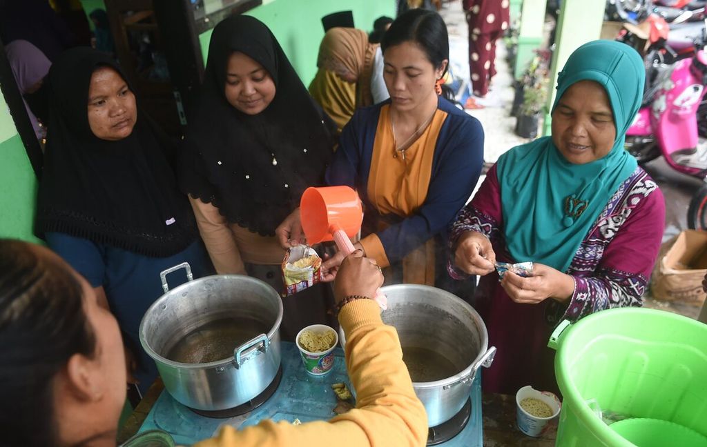
Kompas/Bahana Patria Gupta
Refugees queue to get hot water to make boiled noodles at Supiturang 4 Elementary School in Supiturang Village, Pronojiwo District, Lumajang Regency, East Java, Monday (6/12/2021).
"The dimension [of the hot cloud] is getting smaller, but we must remain vigilant. There is still the potential for hot clouds and lava flow," said Geological Agency secretary Ediar Usman.
A team from the PVMBG is continuing to monitor locations affected by the eruption and hot ashfall. The monitoring data is being used to update the map of disaster-prone areas. “[This is to] identify those areas that cannot be inhabited in future. It is not impossible that a similar threat will appear again," he said. (BRO/NIK/NCA/TAM)
(This article was translated by Hendarsyah Tarmizi).