Two earthquakes occurred on Tuesday (27/4/2021). The earthquake in the morning was felt in Gunung Kidul, Yogyakarta, and its surroundings. The earthquake in the afternoon was felt from Sukabumi, Bandung, to Jakarta.
By
AHMAD ARIF/Tatang Mulyana Sinaga/Nino Citra Anugrahanto
·5 minutes read
BMKG
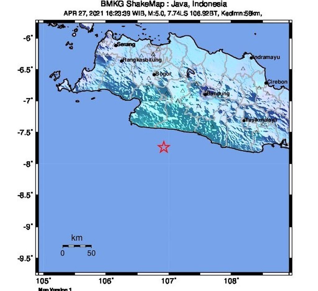
Map of the epicenter of a magnitude 5 earthquake in Sukabumi, West Java, Tuesday (27/4/2021) at 16:23. Source: BMKG
JAKARTA, KOMPAS — Two earthquakes in the Indian Ocean, south of Gunung Kidul, Yogyakarta, and Sukabumi city, West Java, on Tuesday (27/4/2021) originated from different seismic zones. These earthquakes were also not related to each other and had different mechanisms.
Data from the Meteorology, Climatology and Geophysics Agency (BMKG) showed that the earthquake in Gunung Kidul occurred at 10:45 a.m. Western Indonesian Time with a magnitude of 4.6 M. The epicenter of the earthquake was at the coordinates of 8.7 South Latitude (LS) and 110.2 East Longitude (BT), or to be precise at sea at a distance of 91 kilometers (km) southwest of Gunung Kidul city with a depth of 24 km.
"By paying attention to the location of the epicenter and the depth of the hypocenter, the earthquake that occurred was a type of shallow earthquake due to faulting on the seabed," said head of BMKG’s earthquake and tsunami mitigation section Daryono.
According to reports from the Yogyakarta Geophysics Station, the earthquake was also felt in a number of areas, including Gunung Kidul, Bantul, and Sleman regency in Yogyakarta; and Wonogiri in Central Java. Tremors were not only felt by people, but could also be seen from the light objects that were hung to sway.
Contacted separately, the head of the Gunung Kidul Regional Disaster Mitigation Agency (BPBD), Edy Basuki, said that his party had not received any reports of damage caused by the earthquake. There was no panic in the community. Even so, all parties were asked to remain calm.
Meanwhile, the earthquake that hit Sukabumi with a magnitude of 5.6, which was later updated to M 5, occurred at 4:23 p.m. of the Western Indonesia Time. The epicenter of the earthquake was located at the coordinates of 7.74 South Latitude and 106.92 East Longitude, or precisely located at sea at a distance of 89 km south of Sukabumi city with a depth of 58 km.
Kompas
The location of the epicenter of the earthquake on Tuesday (27/4/2021) in the south of Gunung Kidul (in green), the epicenter in the south of Sukabumi (in blue), and the epicenter of the earthquake that triggered the 2006 tsunami in Pangandaran and the 1994 Banyuwangi tsunami. Source: BMKG
Head of BMKG’s Earthquake and Tsunami Center Bambang Setiyo Prayitno said the earthquake that occurred in Sukabumi was classified as shallow due to subduction activity. "The analysis of the source mechanism showed that the earthquake had horizontal movement," he said.
This earthquake tremors were felt in the areas of Sukabumi, Rangkasbitung, Bayah, Cihara, Cilograng, Panggarangan, Bogor with the strength of III Modified Mercalli Intensity (MMI). On this scale, the tremors are felt real in the house as if a truck is passing by. The earthquake was also felt in South Tangerang, Jakarta and Bandung with a scale of II MMI or tremors were felt by several people and caused light objects that were hung to sway.
Tika, 27, a resident of Sagaranten district, Sukabumi regency, said that the tremor was felt for more than five seconds. “The ground shook quite fast. Several residents rushed out the house, but did not panic," he said.
A number of residents in the Bandung city, about 97 km from Sukabumi, felt the earthquake in about three seconds. Several people in the multi-storey buildings got out of the buildings.
“The tremors were felt on the third floor. However, on the ground floor it was almost imperceptible. After five minutes we went back into the buildings,” said Agung, 31’ at Jalan RE Martadinata, Bandung.
The tremors were felt on the third floor.
As of 5:05 p.m. on Tuesday, BMKG monitoring results had not shown any aftershock activity. People were advised to avoid buildings that were cracked or damaged by the earthquake.
KOMPAS/HERU SRI KUMORO
The Patuk 1 Elementary School (SD) Building, Patuk District, Gunung Kidul, DI Yogyakarta, collapsed due to the earthquake in the third week of May 2020. As of Sunday (28/5/2020), the building had not been repaired.
Not triggering tsunami
Neither the earthquakes to the south of Gunung Kidul nor south of Sukabumi meet the criteria for triggering a tsunami. To trigger a tsunami, generally an earthquake occurs at sea with a strength of about M 7 and above. "Gunung Kidul and Sukabumi were not related to each other, their sources were different," said Daryono.
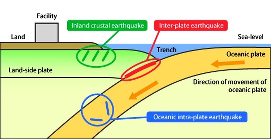
According to Daryono, the earthquake in Sukabumi had a mechanism like the one in southern Malang, East Java, on April 11, 2021, namely in the arm of the plate under subduction. The earthquake south of Gunung Kidul was in the arm of a plate near the mainland. Meanwhile, the earthquakes that triggered the tsunami in Pangandaran (2006) and Banyuwangi (1994) occurred right in the zone where the plates meet.
The subduction zone in the south of Java Island is known to harbor the potential for large earthquakes. A study by the Bandung Institute of Technology (ITB) research team published in the international journal Nature, Sept. 17, 2020, shows that the height of the tsunami caused by the earthquake in this zone can reach 20 meters and an average of 4.5 meters along the southern coast of Java.
The earthquake zone in southern Java is identified as a seismic gap, namely an active seismic zone that is storing energy and has the potential for a major earthquake in the future. This longitudinal seismic gap is said to be able to break apart or simultaneously during an earthquake. If the segments south of West Java were released, the earthquake could have a magnitude of 8.9 with a return period of 400 years.
For the same return period, segments in Central and East Java could trigger an M 8.8 earthquake. If the two segments break up in one earthquake, it will have a magnitude of 9.1 or the equivalent of the Aceh earthquake in 2004.