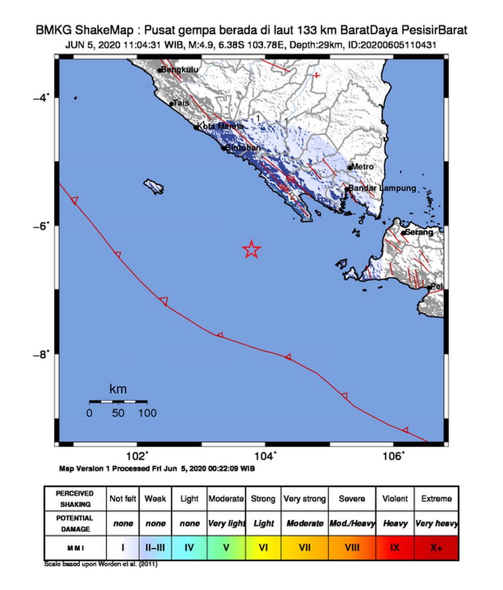
A tectonic earthquake with a magnitude of 4.9 shook Lampung province at 11:04 a.m. on Friday. The earthquake, which was centered in the sea of Pesisir Barat regency, did not have the potential to cause a tsunami.
By
VINA OKTAVIA
·2 minutes read
KOMPAS/VINA OKTAVIA
Hundreds of people evacuate to the office of the Lampung provincial government for fear of a tsunami after an earthquake measuring 6.9 shakes the Sunda Strait area on 2 August 2019.
BANDAR LAMPUNG, KOMPAS - A tectonic earthquake with a magnitude of 4.9 shook Lampung province at 11:04 a.m. on Friday. The earthquake, which was centered in the sea of Pesisir Barat regency, did not have the potential to cause a tsunami.
The head of the North Lampung geophysics station, Anton Sugiharto, said according to the analysis of the Meteorology, Climatology and Geophysics Agency (BMKG), the epicenter was 133 kilometers southwest of Pesisir Barat regency with a depth of 29 kilometers. The earthquake occurred due to subduction between the Indo-Australian plate and the Eurasian plate.
Until now there have been no reports of aftershocks or damage to buildings due to the incident. Even so, a number of residents in Krui, the capital of Pesisir Barat regency and Liwa, the capital of West Lampung regency, West, felt the earthquake shocks with II-III Modified Mercalli intensity scale (MMI).
Based on the BMKG explanation on its official website, MMI scale II means that the earthquake was felt by some and objects shook. The MMI scale III indicated that the earthquake was felt inside homes, as if a truck passed. The highest MMI scale is XII.
Fitria, 29, a resident of Liwa, West Lampung, said she felt a small shock for three to five seconds. Even so, the earthquake did not make residents panic or run outside their houses.
Anton also urged the public to remain calm and to not be influenced by news from unreliable sources. Based on BMKG studies, the Sunda Strait is an earthquake-prone area because it is crossed by the Sumatra fault zone and near the plate subduction zone. The earthquake occurred due to subduction activity of the IndoAustralian plate to the bottom of the Eurasian plate.
While the earthquake hypocenter was in the Megathrust-Benioff transition zone, the plate subduction zone, began to dip beneath the Eurasian plate, south of the Sunda Strait. This condition makes Lampung vulnerable to earthquakes because it is located near the plate subduction zone and crossed by the Sumatra fault zone.
The last destructive earthquake in Liwa, West Lampung, occurred on 15 Feb. 1994. At that time, the disaster left 196 people dead and 2,000 injured.