The Selayar Islands protect Wakatobi in Southeast Sulawesi from the strong current that flows straight to the Takabonerate cluster.
By
·3 minutes read
Kompas/Heru Sri Kumoro
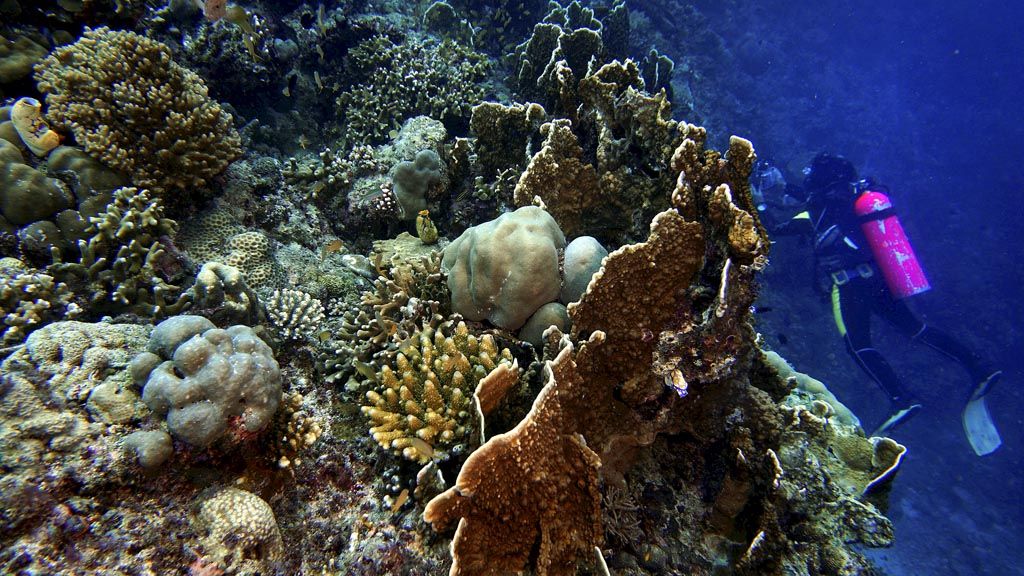
A diver swims alongside a coral reef on Tuesday (24/10) at the Bhayangkara dive spot in the waters off Barat Lembongan village in Selayar Islands regency, South Sulawesi. The dive spot has a wealth of marine biodiversity.
A massive Porites coral, standing over two meters tall, is a hunting sight for divers in the waters behind Tinabo Island Resort in Takabonerate National Park, Selayar, South Sulawesi. Despite the coral’s enormous size, the search for it takes one hour and was even almost called off.
In 2013, Intan Suci Nurhati, a paleoclimatology researcher at the Indonesian Institute of Sciences (LIPI) Oceanography Research Center, who studies primordial climates, took samples from the coral. The coral was part of five spots where samples were taken. Two were in Takabonerate atoll – the biggest atoll in Southeast Asia and the third biggest in the world – two spots were outside Takabonerate atoll and one spot was in the waters off Selayar Island.
The samples were taken to conduct geochemical measurements of the corals. The results of the sample analysis provide information on seawater temperature and salinity level changes over the last few decades and even centuries.
The data is connected to the Indonesian throughflow (Arlindo), which is believed to be linked to climate change. Warm water from the Pacific Ocean heading toward the Indian Ocean is streamed through Arlindo, mostly through the Makassar Strait.
Arlindo, according to oseanografi.lipi.go.id, plays several important functions. The first is as a link between the Pacific Ocean and the Indian Ocean in the tropical zone. Secondly, it has a character that is related to the El Nino and La Nina phenomena. Thirdly, the variations of Arlindo effect the economic activities carried out in Indonesian waters, such as fishery resources. The amount of water that streams through Arlindo is around 1 million cubic meters per second, 80 percent of which flows through the Makassar Strait, with the rest through Lombok Strait, Ombai Strait and the Timor Gap.
Kompas/Ingki Rinaldi
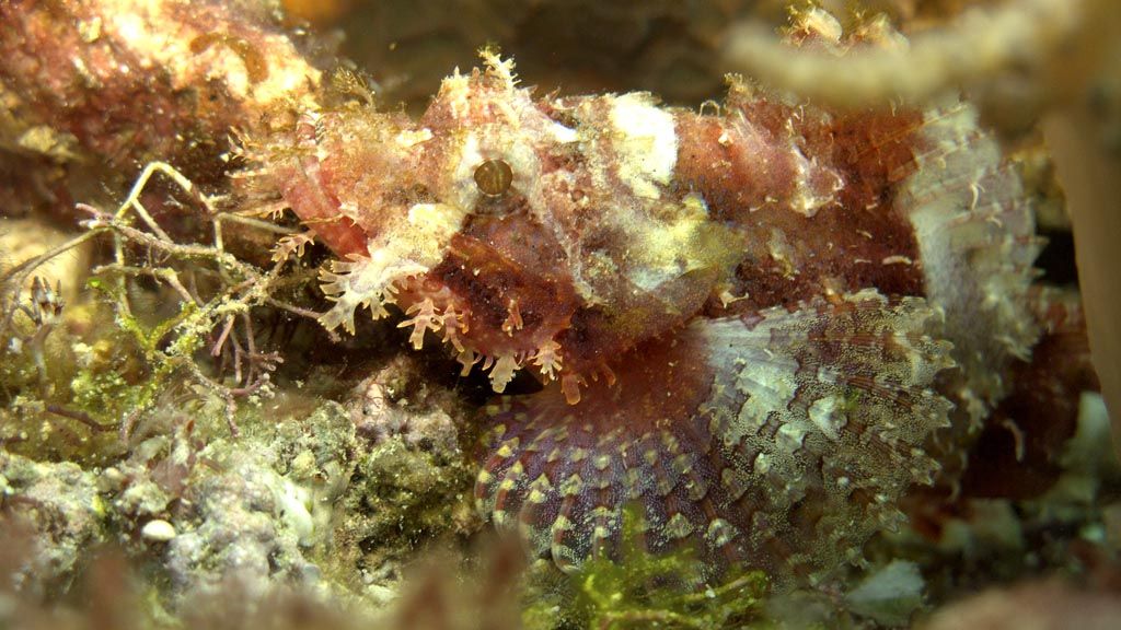
A scorpion fish lies camouflaged on Tuesday (24/10) among the coral at the Bhayangkara dive spot in the waters off Barat Lembongan village in Selayar Islands regency, South Sulawesi.
According to Intan, the study also confirmed that the climate reconstruction data taken from samples from the location outside of the Takabonerate atoll and Selayar was more reliable for finding signs of local and regional climate, as the coral in the Takabonerate atoll, a semi-closed area, and Selayar, which is impacted by sedimentation, tended to have lower levels of reliability.
Strategic waters
Head of the marine geology laboratory at the Bogor Institute of Agriculture, Agus Atmandipoera said that in 2015 an expedition called The Triangle Cruise was carried out. The targets were the Java Sea, the Makassar Strait and the Flores Sea.
The research expedition showed that the maximum current of the Arlindo in Makassar Strait was at a depth of 100 meters, or in the thermocline layer, and that currents were still detected down to a depth of 800 meters. The currents diverge with most heading toward Takabonerate. The Selayar Islands protect Wakatobi in Southeast Sulawesi from the strong current that flows straight to the Takabonerate cluster.
This natural phenomenon makes it a potential sea transportation lane. It is no wonder several historical records refer to the Selayar Islands as a maritime trade area.
The Negarakertagama manuscript (Mpu Prapanca, 1364), describes Selayar as being a stopover place for Majapahit traders. According to another reference, in the 13th century, the islands formed a sea trade zone called the Java Sea marine trade zone. The zone was under the hegemony of the Majapahit Kingdom (Pelautkah Orang Selayar, Ahmadin, 2006).
Textiles, coconuts and sea cucumbers were the main commodities that contributed to Selayar’s past success. However, today, signs of the location’s success, which is also known as Tana Doang, interpreted as meaning doa (prayer) or udang (shrimp), are faint, just like a coastal breeze.