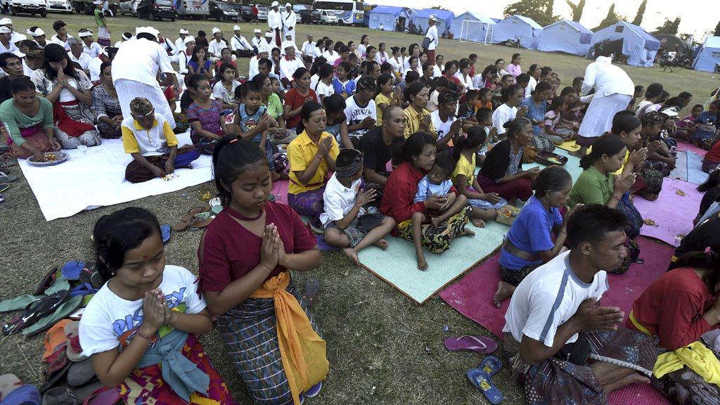
Evacuees take part in the mass Agni Hotra fire ritual on Sunday (8/10) at the Swecapura Sports Hall evacuation camp in Klungkung regency, Bali. The purification and cleansing ritual ceremony is asked for the people to be blessed with patience in facing trials, particularly the Mount Agung disaster.
KARANGASEM, KOMPAS – Up until the 17th day, or into the third week, since the alert status of Mount Agung in Bali was raised to the highest level of Awas (Warning), the latest information on the activity of the volcano has not been disseminated well. As a result, local residents and evacuees are still haunted by fears raised by Mount Agung’s fluctuating condition.
Their concern over the mountain’s activity prompted several residents to go to the Mount Agung Observation Post in Rendang district, Karangasem regency, Sunday (8/10). They were worried about the columns of white smoke, which appeared to be higher than usual. The smoke columns, which are usually 50-200 meters high, was seen to rise to 1,000-1,500 meters from the mountain’s crater on Saturday night.
“We want clear information, so there is no mistaken anticipation. From my house, the smoke above the crater looks white, then black and then white again,” said Ketut Rasta, 45, who lives in Pakraman Pemuteran village, Rendang district.
It was not only local residents that visited the observation post, and even Klungkung Disaster Mitigation Agency head I Putu Widiada had to stop by for confirmation on the correct information regarding the smoke column. He said that the evacuees were concerned about the phenomenon, which had not happened before.
“We will disseminate accurate information. There are thousands of evacuees in Klungkung that need clear information. The right information can prevent (the spread of) false information,” said Putu.
At the Swecapura Sports Hall in Klungkung, Ni Ketut Lasti, 35, an evacuee from Bebandem village, Bebandem district, Karangasem, said that he had never received information on the latest condition of Mt Agung. The disaster mitigation officials had never informed them about developments of the mountain. As a result, the information they received came from either fellow evacuees or social media.
“We have received information about [what to do at the time of] eruption, such as staying near the tent, wearing masks and long-sleeved clothing. However, latest information on the mountain’s condition has not been disseminated,” he said.
Potential looms
Without sufficient information, I Wayan Kariane, 45, has gone back and forth from the evacuation center to his house in Muncan village, Selat district, Karangasem. Even though he knows that his house is in the high-risk area within 9 kilometers from the mountain’s summit, he wants to ensure the safety of his house and feed his cattle.
Volcano Mitigation head Gede Suantika at the Center for Volcanology and Geological Hazards Mitigation (CVGHM) said that the white smoke did not indicate an imminent eruption. It was likely that the smoke was triggered by the rain that had fallen in the last three days.
“The smoke has risen high because the activity of the sulphate aerosols has increased after rain fell in the crater. Seismic monitoring has not indicated any seismic activity that could trigger a higher emission of sulphur dioxide,” said Suantika.
He explained that the white smoke indicated that carbon dioxide was still dominant at about 99 percent. Sulphur dioxide is usually found in large amounts if the color of the smoke above the crater is blackish-brown.
As of Sunday afternoon, said Suantika, the seismicity of Mt Agung remained high and continued to fluctuate. The frequency of tectonic earthquakes was 500-600 times per day, while the frequency of shallow volcanic earthquakes and localized tectonic earthquakes was respectively 300-359 times and 60-70 times per day.
“Based on the monitoring results, the potential of an eruption is still higher than the probability of no eruption. People are still urged to stay on alert and follow the prohibition of human activities in the high-risk zones,” Suantika said.
CVGHM head Kasabani said that his agency would try its best to disseminate the latest information on Mt Agung’s developments. The information will be disseminated through the regional government, other institutions and the CVGHM website.
Data on evacuees
The Klungkung administration is recompiling data on the evacuees in the regency. There are 13 Klungkung villages that are located in the Mt Agung disaster zones, designated at 9 km and 12 km from the mountain’s peak to the north, northeast, southeast, south and southwest.
Data from the Mt Agung Emergency Response Task Unit shows that18,725 evacuees are spread across 43 evacuation posts in Klungkung.
Bali Bovernor I Made Mangku Pastika had said earlier that collecting data on Mt Agung evacuees in Karangasem had been slow. As a result, the exact number of evacuees is as yet unknown. The Bali administration has taken over the task of collecting data from the Karangasem administration.
Klungkung Regent Nyoman Suwirta said that the data collection was being repeated top recent cases of overlapping records. This could happen because of the movement of evacuees from one place to another. “It is important to have a definite figure. This is connected to logistics provisions to evacuees,” he said. The regent added that he would compare data from Klungkung regency with that of the National Disaster Mitigation Agency.