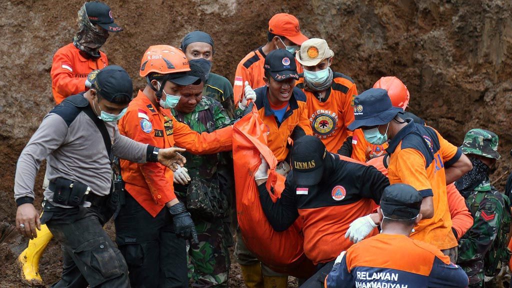
A joint search-and-rescue team picks up a bag containing the dead body of a landslide victim in Banaran village, Pulung district, Ponorogo, East Java, on Monday (3/4/2017).
PONOROGO, KOMPAS — The evacuation of landslide victims in Tangkil hamlet, Banaran village, Pulung district, Ponorogo regency, East Java continues. At 1:20 p.m. on Monday (3/4), the SAR team recovered another dead body.
The body, believed to be that of Sunadi, 47, is the third victim recovered since the disaster hit on Saturday. Twenty-five more victims are predicted to be buried and still missing.
The SAR team deployed 7 excavators and around 1,500 people. The team also deployed 2 sniffer dogs belonging to the East Java K-9 squad and a sniffer dog belonging to East Java search and rescue.
Sunadi was the third victim recovered by the joint SAR team. The two other victims found earlier were Katemi, 65, recovered on Sunday (2/4) at 10:15 a.m., and her grandson Iwan Danang Suwandi, 26, recovered at 10:45 a.m. Both were recovered some 50-100 meters from the location where Sunadi was found.
During the evacuation process, the operation could not run optimally due to heavy rainfall. The SAR operation was often halted due to heavy rain.
Tangkil hamlet is hard to reach. The hamlet on a hilly area about 1,000 meters above sea level has narrow and curvy roads. After the rain, the 3-5 meter-wide road became slippery, causing the motorbike of the SAR team to slip.
Tangkil is 5-6 kilometers from the administration office of South Wagir village, which is on the way to the commercial area of Pulung district. It takes some kilometers of travel along a steep cliff to get there. Such a condition deteriorated with bad communication due to poor cellular connectivity and frequent power outages in the disaster-hit area.
“The obstacle to recovering the victims was the thick soil and the unfriendly weather,” said the head of the Ponorogo Disaster Mitigation Agency (BPBD), Sumani, who is the chief of emergency command.
Residents hope the recovery process can run quickly. “We want the government to stop the disaster from reoccurring,” said Sutrisno, a Tangkil resident.
Banaran village head Sarnu said so far there had been no disaster-awareness drills for residents. In fact, Pulung district is in the disaster-prone area of Ponorogo regency.
Kompas/Wisnu Widiantoro
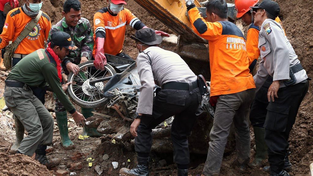
A joint search-and-rescue team lift a motorbike that had been buried in a landslide in Banaran village, Pulung district, Ponorogo, East Java, on Monday (3/4/2017). At the location, the team found three motorbikes and the body of a landslide victim.
Accumulation of problems
Geological Disaster Mitigation and Volcanology Center (PVMBG) disaster emergency team chairman Herry Purnomo said Tangkil was not a residential area. “All areas are prone to disaster. We have searched for a safe place twice but we cannot find one,” he said on the disaster site.
The disaster, which has killed at least three people and has left 25 others missing and buried in Tangkil hamlet, was the result of an accumulation of complex problems, Herry said. Tangkil was surrounded by a steep hill with an elevation angle of more than 40 degrees. The hill was soft and not solid from the weathering of volcanic rock. The geologic structure of the hilly area with the river stream was prone to disaster.
The cultivated and green area was not quite effective because it consisted of seasonal plantations with weak roots such as ginger, cassava and corn. There were bamboo trees on the slope. Bamboo is supposed to be on flat land.
Prior to the landside, Bagus Bestari Kamarullah of the Yogyakarta-based Gadjah Mada University quick assessment team, along with the PVMBG and BNPB teams, said cracks in the ground of the landslide area started to expand. Heavy rainfall fell over Tangkil for three days. The heavy rain continued from Friday midday through the night, or a few hours before the landslide at 7:30 a.m.
The soil became wet, full of water and unstable. The cracks in the ground expanded and then the landslide occurred. “There were complications and then a trigger,” Bagus said.
From the team’s observation, it is known there were cracks on the left and right sides of the landslide. The cracks on the right side were 100 meters long and could potentially expand. Meanwhile, the cracks on the left side were 60 meters long.
(BRO/DIM/AIK)
Kompas/Wawan H Prabowo
An aerial photo of the landslide in Banaran village, Pulung, Ponorogo, East Java, on Monday (3/4/2017). The search-and-rescue effort was hampered by the vast area affected by the landslide and the huge amount of fallen earth.