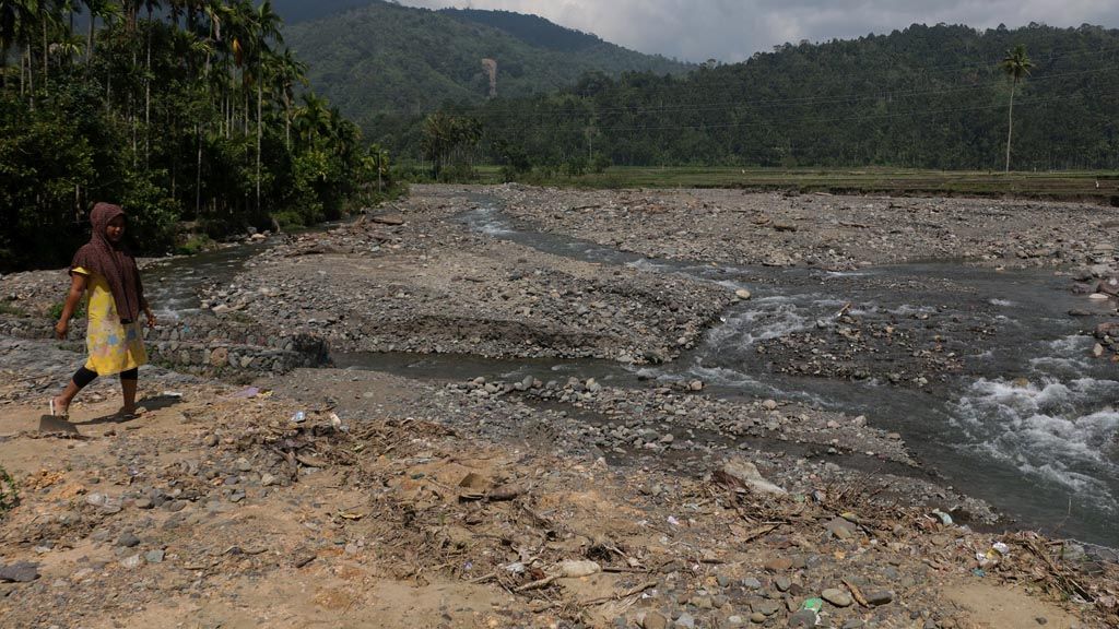
One of tributaries located in the village of Blang Bungong, Tangse, Pidie, Aceh, is damaged after being hit by flash floods on February 6, 2017. The image was recorded on Saturday (18/3). Natural disasters such as floods and landslides have increased in the area. In addition to the high intensity of rainfall, the disasters have been triggered by the destruction of forests, rivers and poor handling system.
JAKARTA, KOMPAS – The intensity and scale of hydrometeorological disasters, including floods, landslides, droughts and forest and land fires, are increasing. Change in weather is one of the many triggers. The major cause is massive environmental damage that leads to the reduction of environmental carrying capacity.
National Disaster Mitigation Agency (BNPB) data shows that the frequency and intensity of disasters in Indonesia has continuously increased in the past 15 years. Some 140 disasters were recorded in 202. The number increased to 740 in 2006 and 2,542 in 2016. Some 95 percent of these disasters are hydrometeorological.
“On average, annual disaster-related financial losses in Indonesia is Rp 30 trillion (US$2.25 billion). It can be higher if large-scale disasters occur,” BNPB spokesman Sutopo Purwo Nugroho said in Jakarta on Sunday (19/3/2017). Losses from forest and land fires in 2015, for instance, reached Rp 221 trillion, equal to 1.9 percent of the national revenue.
Sutopo said several regions had been hit by landslides and floods multiple times without any disaster mitigation plan in sights. He cited the Ciliwung riverbanks in Jakarta, the riverbanks in Ciliwung’s upstream region in southern Bandung, and the Bengawan Solo watershed areas in Bojonegoro, Tuban and Gresik.
New flood-prone regions have also been cropping up, including in Bima, West Nusa Tenggara; Garut regency and Bandung city in West Java; Kemang in Jakarta; Pangkal Pinang in Bangka Belitung and Pasuruan in East Java. “The increase of hydrometeorological disasters in Indonesia is a consequence of increasing disaster-proneness,” he said.
Meteorology, Climatology and Geophysics Agency (BMKG) head Andi Eka Sakya said floods and landslides were closely linked to heavy rainfall as a consequence of climate change. “However, heavy rainfall is not the only cause of flooding in a region. Environmental factors like poor drainage and river infrastructure, deforestation and other factors, can also trigger this,” he said.
BMKG annual heavy rainfall frequency map data from 2009 to 2016 shows that Papua was the region with the highest heavy rainfall frequency. However, the region had the lowest occurrence of floods and landslides in the country in the same period.
“What is most striking is that Java, with its expansive infrastructure development, has an extremely high frequency of floods and landslides,” Andi said.
Based on the data, Andi said it could be concluded that high frequency of heavy rainfall did not necessarily lead to floods and landslides. Condition of the local environment must also be considered.
Critical land
Sutopo said the cropping-up of new flood regions showed the expansion of critical land and development of residential and industrial zones in disaster-prone areas. Upstream regions that should have been zones for forest protection, water catchment and buffer for local hydrologic system have been turned into farmland, mining sites and residences. “Such a conversion has happened for a long time. The impact we are seeing right now is cumulative,” he said.
Separately, BNPB head Willem Rampangilei said the increasing intensity of natural disasters is the result of continuously decreasing environmental carrying capacity. Land use misappropriation triggered massive ecological disasters.
In Banjarnegara, Central Java, threats of flooding in Karangkobar district have increased year after year due to deforestation on the local hills. Gondang hamlet head Darmanto said in Sampang village, Karangkobar, that pines and other perennial vegetation in the forest had been replaced with coffee and elephant grass for animal feed.
Flooding in several regions in Aceh is becoming more frequent. Data from the Aceh Central Statistics Agency shows that six floods occurred in Aceh in 2002. In 2015, there were 65 floods. Deforested land in upstream regions due to illegal logging and mining are believed to have been the cause.
Forest damage due to massive deforestation has occurred in Indonesia since the 1970s. Forestry ministry data shows that deforestation occurred in 22.46 million hectares of land between 1985 and 1997, or an average of 1.87 million hectares per year. Between 1997 and 2000, deforestation rate increased to 2.84 million hectares per year.
SPOT Vegetation imaging data shows the annual deforestation rate was 1.08 million hectares from 2000 to 2005. Landsat 7ETM+ imaging data shows that the rate was 1.17 million hectares from 2003 to 2006. Latest available deforestation data rate was from 2006 to 2009, which was 0.83 million hectares per year.
Environment and Forestry Ministry data shows there were 24.3 million hectares of critical land in 2006, less than the 30.19 million hectares in 2006. Despite the decreasing critical land area, the ministry’s director general for watershed areas and protective forest supervision, Hilman Nugroho, said rehabilitative vegetation had yet to mature enough to be used in flood and landslide mitigation efforts. This is why threats of flood and landslides remain high.
(AIK/DKA/AIN/NDY/ICH)
Editor:
Share
Kantor Redaksi
Menara Kompas Lantai 5, Jalan Palmerah Selatan 21, Jakarta Pusat, DKI Jakarta, Indonesia, 10270.
Tlp.
+6221 5347 710
+6221 5347 720
+6221 5347 730
+6221 530 2200
Kantor Iklan
Menara Kompas Lantai 2, Jalan Palmerah Selatan 21, Jakarta Pusat, DKI Jakarta, Indonesia, 10270.