Abrasion, which continues to erode the shoreline, has eliminated part of the mainland and threatens settlements, infrastructure such as roads and educational facilities, including SDN Bedono 1 state elementary school, Bedono village, Sayung district, Demak regency, Central Java, Friday (17/3). Rehabilitation efforts to restore the damaged mangrove forests continue to reduce the rate of abrasion.
Picturesque rice fields, lines of coconut trees, swaths of fishponds, hundreds of homes and even graveyards have been swallowed by the waves. Little by little, villages in Sayung district of Demak regency, Central Java, are vanishing. The people who still reside there must plan and carry out tactics to face the sea, which is continuously rising as the land subsides.
“When I was little, we had abundant resources, huge rice fields and many coconut trees. The sea was friendly and the fishponds were full of fish,” said Rusipan, 57, a resident of Bedono village in Sayung district.
Prosperity has become a tale of the past in the village, which now comprises houses surrounded by swamps. The residents face a double threat of abrasion and land subsidence. The houses seem to be slowly swallowed by the soil below. In order to live there, the locals need to continuously elevate their homes. That is what Rusipan was doing on Tuesday (14/3/2017). “It is only three years ago that we made the houses one meter higher, but now we are inundated again. Seawater enters our home during high tide,” Rusipan said. “We spend Rp 10 million (US$750) every time we need to add more soil and repair our home. If my children do not help me, I can’t do it alone anymore,” he said.
For Bedono villagers, it is like they are paying rent on their own land, as they must periodically shell out money for repairs to their homes and heighten the soil. Land in the village subsides by around 20 centimeters per year.
Bedono village head Agus Salim said, “Our village is slowly swallowed by the sea. Many of our homes, roads, fishponds and our ancestors’ graves are now underwater.”
Agus said once-prosperous residents with enough money from fishponds had now fell victim to poverty. Some have become factory and construction workers in cities. “Two hamlets, Tambaksari and Rejosari Senik, are now completely deserted. All 250 families of the two hamlets were relocated,” he said.
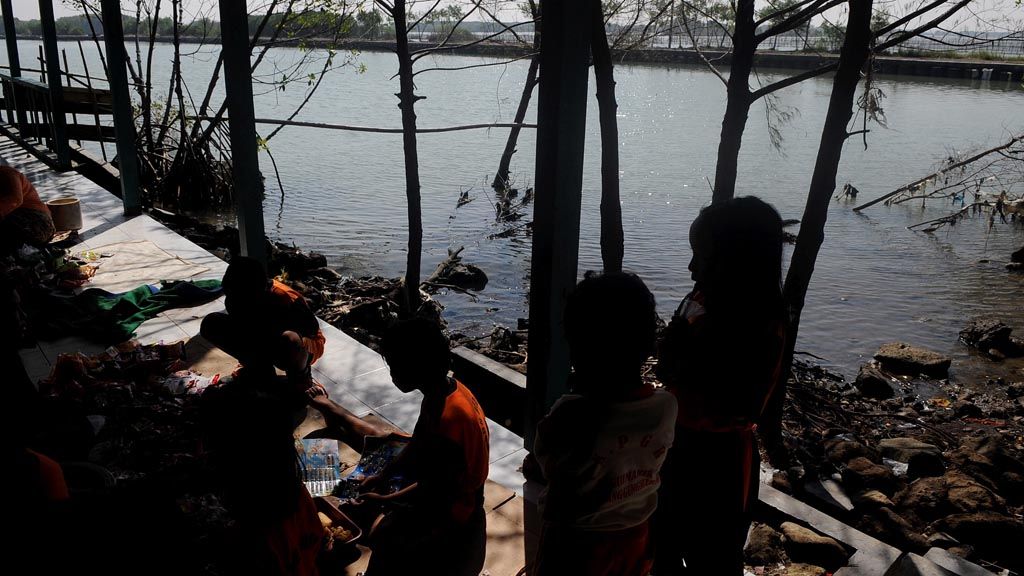
The family of Rokani, 55, is the only one still residing in Rejosari Senik today. Along with his wife Pasijah, 48, and three children, Rokani lives in a house measuring 15 by 7 meters. The house is completely surrounded by seawater, and the only way to go anywhere is by boat.
“I don’t have money to build a house somewhere else,” said Rokani, who works as a fisherman.
Carrying capacity
At the current rates of abrasion and land subsidence, it is only a matter of time before the villages on the northern shore of Central Java completely vanish from maps. Research from the Maritime Affairs and Fisheries Ministry shows that the shoreline in Sayung district is retreating at a rate of 76.4 meters per year.
Data from the center of science and technological excellence at Diponegoro University’s Center for Disaster Mitigation and Rehabilitation Studies show that from 1991 to 2014 abrasion affected an 8.5-kilometer stretch of beach near the border of Demak and Semarang, damaging a total area of 2,073 hectares.
Center of science and technological excellence head Muhammad Helmi said abrasion in Sayung district was caused by four factors, namely land subsidence, the conversion of mangrove swamps into fishponds, land reclamation and beach area infrastructure projects as well as the rising sea level.
The rising sea level is triggered by global climate change. However, the rise of the sea level in the area near the Semarang-Demak border is seen as insignificant at an average of 7.8 millimeters per year. Land subsidence due to excessive groundwater use and the burden of tall buildings that exceed the carrying capacity of soft alluvial soil are the main factors.
Diponegoro University department of oceanography head Denny Nugroho Sugianto said the clearing of mangrove forests has robbed the shoreline of its important protective vegetation. “At the same time, the construction of Tanjung Emas harbor claimed sea areas. Waves that had originally been broken in the middle of the area are now moving to the sides,” Denny said.
Environmental damage in Sayung started in the early 1990s, when rice fields and mangrove lands were converted into fishponds. Locals kept milkfish that could be harvested twice a year. They got their daily income from small fishes and stray shrimps.
“We had never spread any shrimp seedlings here and yet we could harvest between 30 kilograms and 50 kilograms per day. The seawater brings the shrimp eggs and seedlings into our fishponds,” Rusipan said.
The abundant fishpond resources saw locals expand the area. More mangrove trees were cut down. At the same time, factories were built in Demak and northern Semarang. Reclamation projects in Semarang were becoming larger and a ship-docking basin that extended 1.8 kilometers into the sea was built at the Tanjung Emas harbor.
Tidal floods became more frequent, even if they subsided during low tide. In 2006, a tidal flood swallowed almost all villages. “The tidal flood did not subside as our land was already lower than the sea,” Rusipan said.
The environmental destruction in Sayung, Diponegoro University professor of environmental management Sudharto P Hadi said, was a real example of increasing natural disasters. “Abrasion occurs on almost the entire northern shore on Java. The cause is mostly the same, namely reclamation, land subsidence due to excessive groundwater use and the burden from buildings and the destruction of mangrove ecosystems. Upstream, flashfloods and landslides are becoming more common,” he said.
Maritime Affairs and Fisheries Ministry data show that the abrasion rate in Indonesia is 1,950 hectares per year, with a total landmass of 29,261 hectares lost to abrasion from 2000 to 2014. Reaching 6,000 hectares over the past 15 years, abrasion was the most severe on Central Java’s northern shore.
Sudharto said the increasing scale of disasters and ecological destruction should serve as an important lesson for the government to implement development efforts with considerations for the environmental carrying capacity. “The risk of disaster due to development must be considered, as the cost to restore damaged environment is huge. The restoration itself can be very difficult,” he said.
Various measures have been taken to try and halt the rate of abrasion in Sayung, especially by planting more mangroves in the area. However, newly planted mangroves are often swept away by the sea. In the last three years, the Maritime Affairs and Fisheries Ministry and the Public Housing and Public Works Ministry, in cooperation with Wetlands International and Dutch consortium Ecoshape, have established a hybrid structure in the form of bamboo and wooden piles on the beach in Bedono. The piles’ main function is to trap sedimentation mud. When the mud reaches 50 centimeters high, mangroves can be planted.
The Maritime Affairs and Fisheries Ministry’s head of disaster mitigation and climate change adaptation sub-directorate, Hendra Yusran Siry, said that coastline recovery method would cost Rp 250 billion if applied to a 25-kilometer stretch of beach.
This is the cost the nation has to pay to avoid Bedono village from getting wiped off the map.
Editor:
Share
Kantor Redaksi
Menara Kompas Lantai 5, Jalan Palmerah Selatan 21, Jakarta Pusat, DKI Jakarta, Indonesia, 10270.
Tlp.
+6221 5347 710
+6221 5347 720
+6221 5347 730
+6221 530 2200
Kantor Iklan
Menara Kompas Lantai 2, Jalan Palmerah Selatan 21, Jakarta Pusat, DKI Jakarta, Indonesia, 10270.